NorwayCounty number 32

Akershus

Akershus is a county in Norway with 21 municipalities. Akershus surrounds Oslo with urban settlements, farmland, forests and fjord coastline. Asker and Bærum, Follo and Romerike are linked by the capital labour market, Gardermoen and knowledge centres such as Campus Ås.

Content updated:

AI-generated illustration: Akershus (county), Norway
Cultivated fields, a lake and a traditional manor house.Regional illustration
Residents
749,2072026 · SSB
Land area
5,472 km²2026 · SSB
Residents per km² of land
136.92026
Municipalities
219 Oct 2026

SSB · 2026

The county in numbers

See how many people live in the county, how many homes it has, and which municipalities have the most residents. Figures are from Statistics Norway (SSB).

PopulationLatest available count
752,98630 June 2026
Population change2025–2026
Not available
We can’t calculate the change from the available figures.
Number of homesHouses and flats
318,9052026

The county on the map

Municipalities in the countyAkershus · 21 municipalities

Choose a municipality to open its profile. Small island municipalities are marked with a dot.

Municipalities in the county · AkershusChoose a municipality to open its profile. Small island municipalities are marked with a dot.Aurskog-HølandNesEidsvollLillestrømAskerNannestadLunnerHurdalUllensakerEnebakkJevnakerNordre FolloBærumNittedalVestbyÅsFrognGjerdrumRælingenLørenskogNesoddenN
Akershus
Map data: © Kartverket · CC BY 4.0Generalised coastal map (2024) · About the map dataMunicipal structure checked:

Known for

Akershus

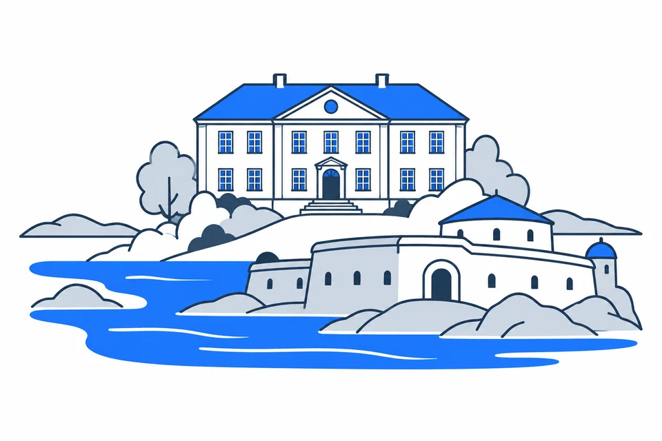
Eidsvoll House and Oscarsborg Fortress

AI-generated illustration: Akershus. Eidsvoll House and Oscarsborg Fortress.

Around Oslo, from the fjord to Romerike

Akershus includes Asker and Bærum west of Oslo, Follo to the south and Romerike to the north and east, as well as Lunner and Jevnaker. It combines dense development near the capital with extensive farmland and forests. Several municipalities form part of the Oslo urban settlement although Oslo is a separate county. Administrative boundaries and actual home–work–education connections both matter.

Constitutional birthplace and new county boundaries

Norway’s Constitution was drafted at Eidsvoll in 1814, a local event with lasting national significance. Railways, the airport and urban growth later strengthened links with Oslo. Akershus joined Viken in 2020 and became a separate county again in 2024. Its present boundaries include Lunner and Jevnaker, former Røyken and Hurum within Asker, and former Rømskog within Aurskog-Høland. Historic maps may therefore show different boundaries.

Airport and labour markets

The Gardermoen region grew following the establishment of Oslo Airport. Transport and trade shape its economy, while road and rail connect it to jobs in Lillestrøm and Oslo.

Airport, research and a shared labour market

Gardermoen gives Ullensaker and neighbouring municipalities a substantial transport, logistics and commerce cluster. Other parts of Akershus host knowledge businesses, services, agriculture and research. Campus Ås connects Follo with environmental and life sciences. Many people commute across the Oslo county boundary. Industries therefore vary substantially, and total population does not indicate where jobs are or which qualifications they require.

Journeys across the Oslo boundary

Ruter plans bus and boat services in Oslo and Akershus and works with metro and tram operators. Trains support the region’s major travel corridors, with local buses continuing into residential areas. Oslo Airport at Gardermoen lies in Akershus, spanning Ullensaker and Nannestad municipalities. When assessing housing, connections, frequency and the final service matter as much as kilometres to the capital; use a current planner for the specific route.

Campus Ås and the history of democracy

NMBU at Ås brings together environmental science, life sciences, technology and veterinary medicine. Eidsvollsbygningen offers another learning route: the development of the Constitution and Norwegian self-government in 1814. University education, upper-secondary schools and local cultural venues operate across both urban and rural areas. Studying education alongside historic places reveals Akershus as more than the capital’s surrounding region.

Urban growth and rural communities in one region

Akershus is closely connected with Oslo but also contains municipalities with longer distances and dispersed settlement. Housing markets and education and transport access vary between subregions. Population growth can create school and infrastructure needs while farmland and nature require protection. Municipality profiles explain these differences better than a single county average, especially when comparing capital-adjacent communities with outer Romerike or Hadeland.

Land use and mobility consultation

The proposed joint land-use and mobility plan for Oslo and Akershus is open for consultation until 23 October 2026. It aims to coordinate development, transport and nature protection towards 2040.


Places with a story

Landscapes, heritage sites and buildings offer a concrete view of the county’s history. Continue to the guides to these places and their municipalities.

  • Lillestrøm

    Fetsund lenser

    Fetsund lenser in Lillestrøm preserves a timber-floating workplace on the Glomma. The river structures explain how logs from inland forests were sorted and bundled before continuing across Øyeren toward the industrial users farther downstream.

  • Bærum

    Henie Onstad Kunstsenter

    Henie Onstad Kunstsenter brings art and fjord landscape together at Høvikodden in Bærum. The low museum buildings, changing exhibitions and surrounding sculpture park offer complementary ways to experience a centre associated with modern art and performance.

  • Nordre Follo

    Roald Amundsens hjem Uranienborg

    Roald Amundsens hjem Uranienborg at Svartskog preserves the explorer's private world beside the Bunnefjord. In Nordre Follo, a furnished house reveals how domestic life, expedition planning and international travel came together between 1908 and 1928.

More attractions in the county

Akershus · 21 municipalities

All municipalities

Find local figures, history, education, housing and public services. Each municipality’s population figure refers to the stated period.

What does a county do?

Norway has three elected levels of government: the state, county authorities and municipalities. A county is both a geographical area and the territory of an elected regional authority.

The county authority

Responsibilities include upper secondary education, county roads, public transport, public dental services and regional development. These tasks connect municipalities.

The municipality

Local responsibilities include primary and lower secondary schools, kindergartens, health and care services and land-use planning. Kommuneportal explains these at municipal level.

The state and the County Governor

The County Governor represents the state regionally. This is a separate institution from the elected county authority. Oslo has both municipal and county responsibilities.

Questions and answers

What is Akershus known for?
Akershus surrounds Oslo with urban settlements, farmland, forests and fjord coastline. Asker and Bærum, Follo and Romerike are linked by the capital labour market, Gardermoen and knowledge centres such as Campus Ås.
How many municipalities are there in Akershus?
Akershus has 21 municipalities in the dated municipal register used on this page. The complete list links to each municipality with local facts, statistics and services.
What is the difference between a county and a municipality?
A county is a regional division that usually contains several municipalities. The county authority is responsible for areas including upper secondary education, county roads, local public transport, public dental services, regional development and culture. Municipalities provide local services close to residents.
How has Akershus developed as a county?
Norway’s Constitution was drafted at Eidsvoll in 1814, a local event with lasting national significance. Railways, the airport and urban growth later strengthened links with Oslo. Akershus joined Viken in 2020 and became a separate county again in 2024. Its present boundaries include Lunner and Jevnaker, former Røyken and Hurum within Asker, and former Rømskog within Aurskog-Høland. Historic maps may therefore show different boundaries.
How should I read the statistics on this page?
Read the reference period and source alongside each figure. County figures calculated from municipalities require complete coverage and comparable periods. Municipalities and urban settlements are different geographic units, so the list of large municipalities is not a ranking of cities.

SamfunnPrep

Understand Norway. Keep learning.

Practice social studies with questions, clear explanations and mock exams.

Exam centres in Akershus

Find a place to take the social studies test, with addresses and contact details.

View exam centres
Sources and illustrations

Sources and methodology

Registry date: · Content updated:

A county total is shown only when every municipality has comparable figures from the same source and period. Land area excludes freshwater and sea. Density uses population and land area from the same year.

The same municipality membership is used; changes across a documented geographical break are withheld.

Statistical evidence

Sources and methodology

About the illustrations

AI-generated illustration: Akershus (county), Norway

An artistic interpretation, not a photograph or an exact record of the place.

Official code
32 · Akershus
Dimensions and format
1200 × 800 · WebP
Credit
SamfunnPrep · AI-generated illustration
Original image
Open full-size image

Creation and publication dates are not documented.

Downloading, republishing, adapting and commercial use require written permission. Image use and permission

About the place: Akershus · Original image