NorwayCounty number 11

Rogaland

Rogaland is a county in Norway with 23 municipalities. Rogaland connects Jæren’s farmland with Ryfylke’s fjords, Haugalandet’s coastal towns and the energy communities around Stavanger. Shipping, agriculture and petroleum history explain much of its modern role.

Content updated:

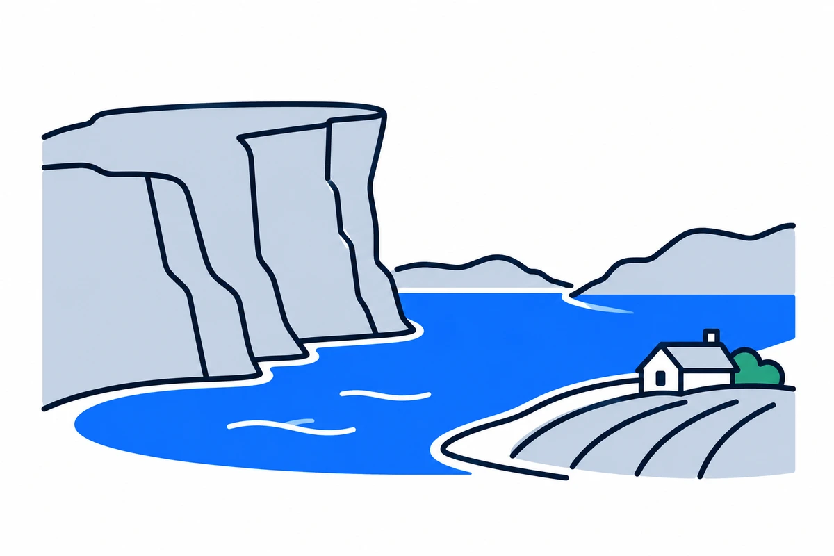
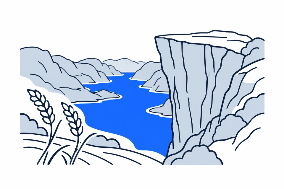
AI-generated illustration: Rogaland (county), Norway
A steep cliff, fjord and cultivated coastal landscape.Regional illustration
Residents
508,9222026 · SSB
Land area
8,570 km²2026 · SSB
Residents per km² of land
59.42026
Municipalities
239 Oct 2026

SSB · 2026

The county in numbers

See how many people live in the county, how many homes it has, and which municipalities have the most residents. Figures are from Statistics Norway (SSB).

PopulationLatest available count
509,85830 June 2026
Population change2025–2026
Not available
We can’t calculate the change from the available figures.
Number of homesHouses and flats
228,9122026

Municipalities with the most residents

Ranked by municipal population, rather than the size of cities or urban settlements. A municipality may contain several settlements and extensive rural areas.

  1. StavangerResidents: 151,669 · 29.8 % of the county’s residents
  2. SandnesResidents: 85,785 · 16.9 % of the county’s residents
  3. KarmøyResidents: 43,990 · 8.6 % of the county’s residents
  4. HaugesundResidents: 38,663 · 7.6 % of the county’s residents
  5. SolaResidents: 29,541 · 5.8 % of the county’s residents

2026 · SSB

The county on the map

Municipalities in the countyRogaland · 23 municipalities

Choose a municipality to open its profile. Small island municipalities are marked with a dot.

Municipalities in the county · RogalandChoose a municipality to open its profile. Small island municipalities are marked with a dot.SuldalHjelmelandSandnesBjerkreimVindafjordGjesdalSaudaEigersundTysværLundSokndalHåStrandStavangerKarmøyTimeKleppHaugesundSolaBoknRandabergUtsiraKvitsøyN
Rogaland
Map data: © Kartverket · CC BY 4.0Generalised coastal map (2024) · About the map dataMunicipal structure checked:

Known for

Rogaland

Preikestolen and the open landscapes of Jæren

AI-generated illustration: Rogaland. Preikestolen and the open landscapes of Jæren.

From Jæren to Ryfylke

Rogaland lies in southwestern Norway. Jæren has open farmland and beaches, while Ryfylke has deep fjords and mountains. Dalane in the south and Haugalandet in the north have distinct coastal and industrial communities. Stavanger and Sandnes form a continuous urban area on Nord-Jæren; Haugesund is an important northern centre. Contrasts between farming districts, islands and cities mean a county average tells only part of the story.

Sea trade and the transition to petroleum

Coastal trade, fishing and agriculture shaped Rogaland long before petroleum. The 1969 Ekofisk discovery in the North Sea and the start of production in 1971 opened a new phase of skills and jobs. The Stavanger area became a major centre for Norway’s petroleum industry. Rogaland did not merge with another county in the 2020 regional reform. It combines older local identities with an international energy economy.

Food, energy and the sea

The county’s business strategy builds on strengths in food, tourism and experiences, energy and maritime activity. Its December 2025 revision emphasises skills and economic adaptation.

Food production meets energy expertise

Rogaland’s business strategy prioritises food, tourism and experiences, and energy and maritime activity. Agriculture and processing on Jæren sit alongside offshore technology and marine supply industries. Transition therefore involves new energy solutions and developing existing expertise. Vocational education, apprenticeships and higher education connect these industries with the future labour market.

Urban journeys, fjord crossings and islands

Kolumbus provides information on buses, express boats and ferries in Rogaland. Connections between Stavanger, Sandnes and neighbouring municipalities support commuting on Nord-Jæren, while boats link islands and fjord communities with larger centres. The county authority manages county roads and school transport. Travel needs differ between Jæren and Ryfylke; compare the complete journey and last departure when assessing places to live.

University, museums and coastal expertise

The University of Stavanger combines research, education and its Museum of Archaeology. Western Norway University of Applied Sciences has a campus in Haugesund. These institutions provide routes into technology, health, teacher education and regional history. The Norwegian Petroleum Museum explores petroleum history, while agricultural and maritime heritage help explain why Rogaland’s identity extends beyond energy alone.

Different everyday lives in one county

Housing, work and services need local assessment in Rogaland. Nord-Jæren has an interconnected labour market, while island municipalities and inland communities have different distances and industries. Farmland protection matters where food production meets urban growth; nature and accessible transport matter in fjord and coastal areas. Municipality profiles make these differences comparable using consistent statistical measures and explicit reference years.

Adopted nature and climate plan

The nature and climate transition plan for 2026–2050 was adopted on 16 June 2026 with an action programme. It coordinates work on climate risks, biodiversity and emission reductions.

Places with a story

Landscapes, heritage sites and buildings offer a concrete view of the county’s history. Continue to the guides to these places and their municipalities.
  • Karmøy

    Avaldsnes kirke

    Avaldsnes kirke, also called Olavskirken, stands on Karmøy within an important historic royal place. Its medieval stone walls and later restorations connect kingship, pilgrimage and the maritime route through Karmsundet.
  • Haugesund

    Dokken friluftsmuseum

    Dokken friluftsmuseum on Hasseløy preserves the small-scale world of Haugesund's herring industry. Houses, workshops and a former shop show how maritime employment shaped domestic life as well as the waterfront economy.

  • Stavanger

    Gamle Stavanger

    Gamle Stavanger is a historic wooden neighbourhood where small houses and cobbled streets bring everyday urban history into view. Its significance lies in the preservation of a whole inhabited district, alongside unusually intact individual homes.

More attractions in the county

Rogaland · 23 municipalities

All municipalities

Find local figures, history, education, housing and public services. Each municipality’s population figure refers to the stated period.

Residents · Q2 2026 · SSB

What does a county do?

Norway has three elected levels of government: the state, county authorities and municipalities. A county is both a geographical area and the territory of an elected regional authority.

The county authority

Responsibilities include upper secondary education, county roads, public transport, public dental services and regional development. These tasks connect municipalities.

The municipality

Local responsibilities include primary and lower secondary schools, kindergartens, health and care services and land-use planning. Kommuneportal explains these at municipal level.

The state and the County Governor

The County Governor represents the state regionally. This is a separate institution from the elected county authority. Oslo has both municipal and county responsibilities.

Questions and answers

What is Rogaland known for?
Rogaland connects Jæren’s farmland with Ryfylke’s fjords, Haugalandet’s coastal towns and the energy communities around Stavanger. Shipping, agriculture and petroleum history explain much of its modern role.
How many municipalities are there in Rogaland?
Rogaland has 23 municipalities in the dated municipal register used on this page. The complete list links to each municipality with local facts, statistics and services.
What is the difference between a county and a municipality?
A county is a regional division that usually contains several municipalities. The county authority is responsible for areas including upper secondary education, county roads, local public transport, public dental services, regional development and culture. Municipalities provide local services close to residents.
How has Rogaland developed as a county?
Coastal trade, fishing and agriculture shaped Rogaland long before petroleum. The 1969 Ekofisk discovery in the North Sea and the start of production in 1971 opened a new phase of skills and jobs. The Stavanger area became a major centre for Norway’s petroleum industry. Rogaland did not merge with another county in the 2020 regional reform. It combines older local identities with an international energy economy.
How should I read the statistics on this page?
Read the reference period and source alongside each figure. County figures calculated from municipalities require complete coverage and comparable periods. Municipalities and urban settlements are different geographic units, so the list of large municipalities is not a ranking of cities.

SamfunnPrep

Understand Norway. Keep learning.

Practice social studies with questions, clear explanations and mock exams.

Exam centres in Rogaland

Find a place to take the social studies test, with addresses and contact details.

View exam centres
Sources and illustrations

Sources and methodology

Registry date: · Content updated:

A county total is shown only when every municipality has comparable figures from the same source and period. Land area excludes freshwater and sea. Density uses population and land area from the same year.

The same municipality membership is used; changes across a documented geographical break are withheld.

Statistical evidence

Sources and methodology

About the illustrations

AI-generated illustration: Rogaland (county), Norway

An artistic interpretation, not a photograph or an exact record of the place.

Official code
11 · Rogaland
Dimensions and format
1200 × 800 · WebP
Credit
SamfunnPrep · AI-generated illustration
Original image
Open full-size image

Creation and publication dates are not documented.

Downloading, republishing, adapting and commercial use require written permission. Image use and permission

About the place: Rogaland · Original image